🕌 Seven Kings Mosque (Seven Kings, Redbridge, London)
📩 Address: (Entrance: Telegraph Mews) 645-647 High Road, Seven Kings, Ilford, Essex, IG3 8RG
☎️ Contact: 020 8590 8600 (Muslim Directory 2008), 020 8590 6130 (in 2007), 020 8599 1800 (?) 🧕👨 Gender: Male (Only)
🏪 Type: Masjid/Mosque
📊 Data Accuracy: A - Excellent
📑 Additional Information
🔔 Following: Sunni - Deobandi
👨👨Management: none
📜 Other Names: Muslim Education Trust
👨👩👧👦 Capacity: 600
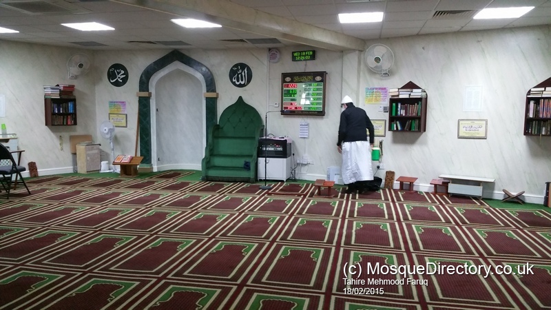
🖼️ Mosque Photo Gallery


⏰ Prayer Times
| Date | Fajr | Dhuhr | Asr | Maghrib | Isha |
|---|---|---|---|---|---|
| 22/03/25 | 04:25 AM | 12:07 PM | 03:26 PM | 06:16 PM | 07:50 PM |
| 23/03/25 | 04:22 AM | 12:06 PM | 03:27 PM | 06:18 PM | 07:52 PM |
| 24/03/25 | 04:19 AM | 12:06 PM | 03:28 PM | 06:20 PM | 07:54 PM |
| 25/03/25 | 04:17 AM | 12:06 PM | 03:29 PM | 06:22 PM | 07:56 PM |
| 26/03/25 | 04:14 AM | 12:05 PM | 03:30 PM | 06:23 PM | 07:58 PM |
| 27/03/25 | 04:12 AM | 12:05 PM | 03:31 PM | 06:25 PM | 08:00 PM |
| 28/03/25 | 05:10 AM | 01:05 PM | 04:31 PM | 07:26 PM | 09:01 PM |
| 29/03/25 | 05:07 AM | 01:05 PM | 04:32 PM | 07:28 PM | 09:03 PM |
| 30/03/25 | 05:05 AM | 01:04 PM | 04:33 PM | 07:30 PM | 09:05 PM |
| 31/03/25 | 05:02 AM | 01:04 PM | 04:34 PM | 07:31 PM | 09:07 PM |
🌦️ Current Weather
Location: Ilford, Essex#68531, UK
Local Time: 2025-03-22 00:54

Weather: Patchy rain nearby
Temperature
11.4 ℃ (52.6 ℉)
Wind
11.2 mph (18 kph)
Degree: 146
Direction: SSE
Gust: 16.9 mph (27.2 kph)
Weather Report
Today on March 22, 2025, the temperature will be 11.4℃ (52.6℉). It will feel like 9.4℃ (48.8℉). The wind will be 11.2 mph (18 kph) and humidity will be 92%.
🌤️ 3-Day Forecast
| Date | Condition | Max Temp (℃/℉) | Min Temp (℃/℉) |
|---|---|---|---|
 2025-03-22 2025-03-22 | Patchy rain nearby | 11.6 ℃ (52.8 ℉) | 9.3 ℃ (48.7 ℉) |
| 2025-03-23 | Patchy rain nearby | 13.2 ℃ (55.8 ℉) | 8.9 ℃ (48 ℉) |
| 2025-03-24 | Patchy rain nearby | 10.7 ℃ (51.2 ℉) | 6.2 ℃ (43.2 ℉) |
🚎 Nearby Transport Links with Timetables
Loading travel information, please wait...
👨💼 Local Parliamentary Information
| Display As: Jas Athwal | List As: Athwal, Jas |
| MP Name: Jas Athwal MP | Gender: Male |
| Constituency: Ilford South | Party Name: Labour |
| Mp parliamentary email: jas.athwal.mp@parliament.uk | House Start Date: 2024-07-04 |
| Status: Current Member |
👮 Local Crime Data
Crime Data for Latitude: 51.56480789, Longitude: 0.09827000
Crime Categories (Highest Count First)
| Category | Count | Action | |
|---|---|---|---|
| VIOLENT CRIME | 203 | Loading... | |
| Month | Street Name | Outcome Category | Outcome Date |
| 2025-01 | On or near Sports/recreation Area | Unable to prosecute suspect | 2025-01 |
| 2025-01 | On or near Sports/recreation Area | Under investigation | 2025-01 |
| 2025-01 | On or near Francis Street | Awaiting court outcome | 2025-01 |
| 2025-01 | On or near High Road | Under investigation | 2025-01 |
| 2025-01 | On or near Eynsford Road | Under investigation | 2025-01 |
| 2025-01 | On or near A118 | Under investigation | 2025-01 |
| 2025-01 | On or near Medici Close | Under investigation | 2025-01 |
| 2025-01 | On or near Eastwood Road | Under investigation | 2025-01 |
| 2025-01 | On or near Riches Road | Investigation complete; no suspect identified | 2025-01 |
| 2025-01 | On or near Sports/recreation Area | Unable to prosecute suspect | 2025-01 |
| 2025-01 | On or near Sports/recreation Area | Under investigation | 2025-01 |
| 2025-01 | On or near Sports/recreation Area | Unable to prosecute suspect | 2025-01 |
| 2025-01 | On or near Erin Close | Unable to prosecute suspect | 2025-01 |
| 2025-01 | On or near Malvern Drive | Under investigation | 2025-01 |
| 2025-01 | On or near Park Road | Under investigation | 2025-01 |
| 2025-01 | On or near Jaffe Road | Under investigation | 2025-01 |
| 2025-01 | On or near Sports/recreation Area | Unable to prosecute suspect | 2025-01 |
| 2025-01 | On or near Aldborough Road South | Unable to prosecute suspect | 2025-01 |
| 2025-01 | On or near Parking Area | Unable to prosecute suspect | 2025-01 |
| 2025-01 | On or near Kent View Gardens | Unable to prosecute suspect | 2025-01 |
| 2025-01 | On or near Eccleston Crescent | Unable to prosecute suspect | 2025-01 |
| 2025-01 | On or near Belmont Road | Under investigation | 2025-01 |
| 2025-01 | On or near Park Road | Under investigation | 2025-01 |
| 2025-01 | On or near Sports/recreation Area | Unable to prosecute suspect | 2025-01 |
| 2025-01 | On or near Sports/recreation Area | Under investigation | 2025-01 |
| 2025-01 | On or near The Close | Under investigation | 2025-01 |
| 2025-01 | On or near Beddington Road | Under investigation | 2025-01 |
| 2025-01 | On or near Sports/recreation Area | Unable to prosecute suspect | 2025-01 |
| 2025-01 | On or near Eastwood Road | Unable to prosecute suspect | 2025-01 |
| 2025-01 | On or near Goodmayes Avenue | Under investigation | 2025-01 |
| 2025-01 | On or near Perth Terrace | Under investigation | 2025-01 |
| 2025-01 | On or near Vicarage Lane | Unable to prosecute suspect | 2025-01 |
| 2025-01 | On or near Clark's Road | Under investigation | 2025-01 |
| 2025-01 | On or near Sports/recreation Area | Investigation complete; no suspect identified | 2025-01 |
| 2025-01 | On or near Telegraph Mews | Unable to prosecute suspect | 2025-01 |
| 2025-01 | On or near Supermarket | Under investigation | 2025-01 |
| 2025-01 | On or near Holmwood Road | Under investigation | 2025-01 |
| 2025-01 | On or near Sports/recreation Area | Under investigation | 2025-01 |
| 2025-01 | On or near Gordon Road | Under investigation | 2025-01 |
| 2025-01 | On or near Meads Lane | Under investigation | 2025-01 |
| 2025-01 | On or near Sports/recreation Area | Unable to prosecute suspect | 2025-01 |
| 2025-01 | On or near Sports/recreation Area | Under investigation | 2025-01 |
| 2025-01 | On or near Durban Road | Under investigation | 2025-01 |
| 2025-01 | On or near Sports/recreation Area | Under investigation | 2025-01 |
| 2025-01 | On or near Eastwood Road | Unable to prosecute suspect | 2025-01 |
| 2025-01 | On or near Colombo Road | Under investigation | 2025-01 |
| 2025-01 | On or near Vernon Road | Unable to prosecute suspect | 2025-01 |
| 2025-01 | On or near Sports/recreation Area | Investigation complete; no suspect identified | 2025-01 |
| 2025-01 | On or near Malvern Drive | Under investigation | 2025-01 |
| 2025-01 | On or near Malvern Drive | Under investigation | 2025-01 |
| 2025-01 | On or near Ley Street | Unable to prosecute suspect | 2025-01 |
| 2025-01 | On or near Sports/recreation Area | Under investigation | 2025-01 |
| 2025-01 | On or near Sports/recreation Area | Unable to prosecute suspect | 2025-01 |
| 2025-01 | On or near Axon Place | Under investigation | 2025-01 |
| 2025-01 | On or near Sports/recreation Area | Under investigation | 2025-01 |
| 2025-01 | On or near Elizabeth Avenue | Under investigation | 2025-01 |
| 2025-01 | On or near Supermarket | Under investigation | 2025-01 |
| 2025-01 | On or near Sports/recreation Area | Unable to prosecute suspect | 2025-01 |
| 2025-01 | On or near Erin Close | Unable to prosecute suspect | 2025-01 |
| 2025-01 | On or near Riches Road | Investigation complete; no suspect identified | 2025-01 |
| 2025-01 | On or near Eccleston Crescent | Under investigation | 2025-01 |
| 2025-01 | On or near Medici Close | Under investigation | 2025-01 |
| 2025-01 | On or near Percy Road | Under investigation | 2025-01 |
| 2025-01 | On or near Sports/recreation Area | Under investigation | 2025-01 |
| 2025-01 | On or near Eccleston Crescent | Under investigation | 2025-01 |
| 2025-01 | On or near Sports/recreation Area | Unable to prosecute suspect | 2025-01 |
| 2025-01 | On or near Park/open Space | Under investigation | 2025-01 |
| 2025-01 | On or near Westernville Gardens | Under investigation | 2025-01 |
| 2025-01 | On or near Sports/recreation Area | Under investigation | 2025-01 |
| 2025-01 | On or near Durban Road | Under investigation | 2025-01 |
| 2025-01 | On or near Newbury Park | Unable to prosecute suspect | 2025-01 |
| 2025-01 | On or near Police Station | Under investigation | 2025-01 |
| 2025-01 | On or near Avenue Road | Unable to prosecute suspect | 2025-01 |
| 2025-01 | On or near Police Station | Under investigation | 2025-01 |
| 2025-01 | On or near Stainforth Road | Under investigation | 2025-01 |
| 2025-01 | On or near Dalkeith Road | Under investigation | 2025-01 |
| 2025-01 | On or near Bush Close | Under investigation | 2025-01 |
| 2025-01 | On or near Holland Park Avenue | Under investigation | 2025-01 |
| 2025-01 | On or near Piper Way | Under investigation | 2025-01 |
| 2025-01 | On or near Malvern Drive | Under investigation | 2025-01 |
| 2025-01 | On or near Westernville Gardens | Under investigation | 2025-01 |
| 2025-01 | On or near Supermarket | Under investigation | 2025-01 |
| 2025-01 | On or near Budoch Drive | Under investigation | 2025-01 |
| 2025-01 | On or near Supermarket | Unable to prosecute suspect | 2025-01 |
| 2025-01 | On or near Durban Road | Under investigation | 2025-01 |
| 2025-01 | On or near Sports/recreation Area | Under investigation | 2025-01 |
| 2025-01 | On or near Monarch Way | Under investigation | 2025-01 |
| 2025-01 | On or near Petrol Station | Under investigation | 2025-01 |
| 2025-01 | On or near Betchworth Road | Under investigation | 2025-01 |
| 2025-01 | On or near B177 | Under investigation | 2025-01 |
| 2025-01 | On or near Oakwood Gardens | Under investigation | 2025-01 |
| 2025-01 | On or near Park/open Space | Under investigation | 2025-01 |
| 2025-01 | On or near Francis Avenue | Under investigation | 2025-01 |
| 2025-01 | On or near Essex Road | Awaiting court outcome | 2025-01 |
| 2025-01 | On or near Westernville Gardens | Unable to prosecute suspect | 2025-01 |
| 2025-01 | On or near Buckingham Road | Under investigation | 2025-01 |
| 2025-01 | On or near Sports/recreation Area | Under investigation | 2025-01 |
| 2025-01 | On or near Douglas Road | Unable to prosecute suspect | 2025-01 |
| 2025-01 | On or near Sports/recreation Area | Under investigation | 2025-01 |
| 2025-01 | On or near Downshall Avenue | Under investigation | 2025-01 |
| 2025-01 | On or near Sports/recreation Area | Unable to prosecute suspect | 2025-01 |
| 2025-01 | On or near Whites Avenue | Under investigation | 2025-01 |
| 2025-01 | On or near Belmont Road | Under investigation | 2025-01 |
| 2025-01 | On or near Police Station | Under investigation | 2025-01 |
| 2025-01 | On or near Bush Close | Under investigation | 2025-01 |
| 2025-01 | On or near Ladysmith Avenue | Under investigation | 2025-01 |
| 2025-01 | On or near Wallington Road | Under investigation | 2025-01 |
| 2025-01 | On or near Meath Road | Under investigation | 2025-01 |
| 2025-01 | On or near Meath Road | Under investigation | 2025-01 |
| 2025-01 | On or near Christie Gardens | Under investigation | 2025-01 |
| 2025-01 | On or near Belmont Road | Under investigation | 2025-01 |
| 2025-01 | On or near Lombard Avenue | Under investigation | 2025-01 |
| 2025-01 | On or near Elizabeth Avenue | Investigation complete; no suspect identified | 2025-01 |
| 2025-01 | On or near Quebec Road | Under investigation | 2025-01 |
| 2025-01 | On or near Kildowan Road | Under investigation | 2025-01 |
| 2025-01 | On or near Park Road | Under investigation | 2025-01 |
| 2025-01 | On or near Lynford Gardens | Unable to prosecute suspect | 2025-01 |
| 2025-01 | On or near Farley Drive | Unable to prosecute suspect | 2025-01 |
| 2025-01 | On or near Sports/recreation Area | Unable to prosecute suspect | 2025-01 |
| 2025-01 | On or near Arandora Crescent | Under investigation | 2025-01 |
| 2025-01 | On or near Francis Street | Under investigation | 2025-01 |
| 2025-01 | On or near Police Station | Under investigation | 2025-01 |
| 2025-01 | On or near Police Station | Under investigation | 2025-01 |
| 2025-01 | On or near Norfolk Road | Under investigation | 2025-01 |
| 2025-01 | On or near Colombo Road | Under investigation | 2025-01 |
| 2025-01 | On or near Sports/recreation Area | Unable to prosecute suspect | 2025-01 |
| 2025-01 | On or near Telegraph Mews | Under investigation | 2025-01 |
| 2025-01 | On or near Monarch Way | Under investigation | 2025-01 |
| 2025-01 | On or near The Close | Under investigation | 2025-01 |
| 2025-01 | On or near Axon Place | Under investigation | 2025-01 |
| 2025-01 | On or near Farnham Road | Under investigation | 2025-01 |
| 2025-01 | On or near Medici Close | Under investigation | 2025-01 |
| 2025-01 | On or near Connaught Road | Under investigation | 2025-01 |
| 2025-01 | On or near High Road | Under investigation | 2025-01 |
| 2025-01 | On or near Park/open Space | Under investigation | 2025-01 |
| 2025-01 | On or near Percy Road | Under investigation | 2025-01 |
| 2025-01 | On or near High Road | Under investigation | 2025-01 |
| 2025-01 | On or near Arundel Gardens | Under investigation | 2025-01 |
| 2025-01 | On or near Budoch Drive | Investigation complete; no suspect identified | 2025-01 |
| 2025-01 | On or near Sports/recreation Area | Under investigation | 2025-01 |
| 2025-01 | On or near Herbert Road | Under investigation | 2025-01 |
| 2025-01 | On or near Norfolk Road | Under investigation | 2025-01 |
| 2025-01 | On or near Sports/recreation Area | Under investigation | 2025-01 |
| 2025-01 | On or near Supermarket | Under investigation | 2025-01 |
| 2025-01 | On or near Douglas Road | Investigation complete; no suspect identified | 2025-01 |
| 2025-01 | On or near Ley Street | Under investigation | 2025-01 |
| 2025-01 | On or near Riches Road | Under investigation | 2025-01 |
| 2025-01 | On or near Eccleston Crescent | Under investigation | 2025-01 |
| 2025-01 | On or near Melford Road | Under investigation | 2025-01 |
| 2025-01 | On or near Farnham Road | Under investigation | 2025-01 |
| 2025-01 | On or near Herbert Road | Under investigation | 2025-01 |
| 2025-01 | On or near Adelaide Road | Under investigation | 2025-01 |
| 2025-01 | On or near Buckingham Road | Unable to prosecute suspect | 2025-01 |
| 2025-01 | On or near Sports/recreation Area | Unable to prosecute suspect | 2025-01 |
| 2025-01 | On or near Sunnyside Road | Under investigation | 2025-01 |
| 2025-01 | On or near Audley Gardens | Under investigation | 2025-01 |
| 2025-01 | On or near Spencer Road | Unable to prosecute suspect | 2025-01 |
| 2025-01 | On or near Water Lane | Under investigation | 2025-01 |
| 2025-01 | On or near Dunkeld Road | Under investigation | 2025-01 |
| 2025-01 | On or near Meath Road | Under investigation | 2025-01 |
| 2025-01 | On or near Thurlestone Avenue | Under investigation | 2025-01 |
| 2025-01 | On or near Lambourne Road | Investigation complete; no suspect identified | 2025-01 |
| 2025-01 | On or near Riches Road | Under investigation | 2025-01 |
| 2025-01 | On or near Ley Street | Investigation complete; no suspect identified | 2025-01 |
| 2025-01 | On or near Norfolk Road | Investigation complete; no suspect identified | 2025-01 |
| 2025-01 | On or near Sports/recreation Area | Unable to prosecute suspect | 2025-01 |
| 2025-01 | On or near Sunnyside Road | Unable to prosecute suspect | 2025-01 |
| 2025-01 | On or near Sports/recreation Area | Unable to prosecute suspect | 2025-01 |
| 2025-01 | On or near Sunnyside Road | Unable to prosecute suspect | 2025-01 |
| 2025-01 | On or near Mannin Road | Unable to prosecute suspect | 2025-01 |
| 2025-01 | On or near Arundel Gardens | Local resolution | 2025-01 |
| 2025-01 | On or near Park/open Space | Unable to prosecute suspect | 2025-01 |
| 2025-01 | On or near Sports/recreation Area | Unable to prosecute suspect | 2025-01 |
| 2025-01 | On or near B177 | Investigation complete; no suspect identified | 2025-01 |
| 2025-01 | On or near Sports/recreation Area | Investigation complete; no suspect identified | 2025-01 |
| 2025-01 | On or near Sports/recreation Area | Unable to prosecute suspect | 2025-01 |
| 2025-01 | On or near Sports/recreation Area | Unable to prosecute suspect | 2025-01 |
| 2025-01 | On or near Cameron Road | Investigation complete; no suspect identified | 2025-01 |
| 2025-01 | On or near Sports/recreation Area | Unable to prosecute suspect | 2025-01 |
| 2025-01 | On or near Sports/recreation Area | Investigation complete; no suspect identified | 2025-01 |
| 2025-01 | On or near Colombo Road | Unable to prosecute suspect | 2025-01 |
| 2025-01 | On or near Alloa Road | Unable to prosecute suspect | 2025-01 |
| 2025-01 | On or near Forterie Gardens | Investigation complete; no suspect identified | 2025-01 |
| 2025-01 | On or near South Park Road | Unable to prosecute suspect | 2025-01 |
| 2025-01 | On or near Sports/recreation Area | Unable to prosecute suspect | 2025-01 |
| 2025-01 | On or near Westernville Gardens | Unable to prosecute suspect | 2025-01 |
| 2025-01 | On or near Durban Road | Unable to prosecute suspect | 2025-01 |
| 2025-01 | On or near Sports/recreation Area | Unable to prosecute suspect | 2025-01 |
| 2025-01 | On or near Sports/recreation Area | Unable to prosecute suspect | 2025-01 |
| 2025-01 | On or near Haslemere Road | Unable to prosecute suspect | 2025-01 |
| 2025-01 | On or near Sports/recreation Area | Unable to prosecute suspect | 2025-01 |
| 2025-01 | On or near Petrol Station | Unable to prosecute suspect | 2025-01 |
| 2025-01 | On or near Sports/recreation Area | Unable to prosecute suspect | 2025-01 |
| 2025-01 | On or near Sports/recreation Area | Unable to prosecute suspect | 2025-01 |
| 2025-01 | On or near Sports/recreation Area | Unable to prosecute suspect | 2025-01 |
| 2025-01 | On or near Westrow Gardens | Unable to prosecute suspect | 2025-01 |
| 2025-01 | On or near Police Station | Investigation complete; no suspect identified | 2025-01 |
| 2025-01 | On or near Sports/recreation Area | Unable to prosecute suspect | 2025-01 |
| 2025-01 | On or near Farley Drive | Investigation complete; no suspect identified | 2025-01 |
| 2025-01 | On or near Sports/recreation Area | Unable to prosecute suspect | 2025-01 |
| 2025-01 | On or near Cardigan Gardens | Unable to prosecute suspect | 2025-01 |
| 2025-01 | On or near Meadway | Unable to prosecute suspect | 2025-01 |
| 2025-01 | On or near Sports/recreation Area | Unable to prosecute suspect | 2025-01 |
| ANTI SOCIAL BEHAVIOUR | 131 | Loading... | |
| Month | Street Name | Outcome Category | Outcome Date |
| 2025-01 | On or near Ripley Road | N/A | N/A |
| 2025-01 | On or near Police Station | N/A | N/A |
| 2025-01 | On or near Elmstead Road | N/A | N/A |
| 2025-01 | On or near Claremont Gardens | N/A | N/A |
| 2025-01 | On or near Elgin Road | N/A | N/A |
| 2025-01 | On or near Gordon Road | N/A | N/A |
| 2025-01 | On or near Melford Road | N/A | N/A |
| 2025-01 | On or near Percy Road | N/A | N/A |
| 2025-01 | On or near Aldborough Road South | N/A | N/A |
| 2025-01 | On or near Royal Crescent | N/A | N/A |
| 2025-01 | On or near Goodmayes Avenue | N/A | N/A |
| 2025-01 | On or near Lombard Avenue | N/A | N/A |
| 2025-01 | On or near Ripley Road | N/A | N/A |
| 2025-01 | On or near Kildowan Road | N/A | N/A |
| 2025-01 | On or near Abbotsford Road | N/A | N/A |
| 2025-01 | On or near Petrol Station | N/A | N/A |
| 2025-01 | On or near Kimberley Avenue | N/A | N/A |
| 2025-01 | On or near Police Station | N/A | N/A |
| 2025-01 | On or near Seven Kings Road | N/A | N/A |
| 2025-01 | On or near Riches Road | N/A | N/A |
| 2025-01 | On or near Goodmayes Road | N/A | N/A |
| 2025-01 | On or near Abbotsford Road | N/A | N/A |
| 2025-01 | On or near Police Station | N/A | N/A |
| 2025-01 | On or near Petrol Station | N/A | N/A |
| 2025-01 | On or near Aldborough Road South | N/A | N/A |
| 2025-01 | On or near Petrol Station | N/A | N/A |
| 2025-01 | On or near Police Station | N/A | N/A |
| 2025-01 | On or near Percy Road | N/A | N/A |
| 2025-01 | On or near Police Station | N/A | N/A |
| 2025-01 | On or near Ley Street | N/A | N/A |
| 2025-01 | On or near Percy Road | N/A | N/A |
| 2025-01 | On or near Fenman Gardens | N/A | N/A |
| 2025-01 | On or near Ripley Road | N/A | N/A |
| 2025-01 | On or near Police Station | N/A | N/A |
| 2025-01 | On or near Goodmayes Lane | N/A | N/A |
| 2025-01 | On or near Kildowan Road | N/A | N/A |
| 2025-01 | On or near Fenman Gardens | N/A | N/A |
| 2025-01 | On or near Huxley Drive | N/A | N/A |
| 2025-01 | On or near Saunders Close | N/A | N/A |
| 2025-01 | On or near Petrol Station | N/A | N/A |
| 2025-01 | On or near Abbotsford Road | N/A | N/A |
| 2025-01 | On or near Ripley Road | N/A | N/A |
| 2025-01 | On or near Aberdour Road | N/A | N/A |
| 2025-01 | On or near Littlemoor Road | N/A | N/A |
| 2025-01 | On or near Homefield Avenue | N/A | N/A |
| 2025-01 | On or near Bush Close | N/A | N/A |
| 2025-01 | On or near Ripley Road | N/A | N/A |
| 2025-01 | On or near Homefield Avenue | N/A | N/A |
| 2025-01 | On or near Petrol Station | N/A | N/A |
| 2025-01 | On or near Goodmayes Lane | N/A | N/A |
| 2025-01 | On or near Police Station | N/A | N/A |
| 2025-01 | On or near Connaught Road | N/A | N/A |
| 2025-01 | On or near Petrol Station | N/A | N/A |
| 2025-01 | On or near Petrol Station | N/A | N/A |
| 2025-01 | On or near Littlemoor Road | N/A | N/A |
| 2025-01 | On or near Parking Area | N/A | N/A |
| 2025-01 | On or near Riches Road | N/A | N/A |
| 2025-01 | On or near Belmont Road | N/A | N/A |
| 2025-01 | On or near Percy Road | N/A | N/A |
| 2025-01 | On or near New Road | N/A | N/A |
| 2025-01 | On or near Kildowan Road | N/A | N/A |
| 2025-01 | On or near Clifton Road | N/A | N/A |
| 2025-01 | On or near Clifton Road | N/A | N/A |
| 2025-01 | On or near High Road | N/A | N/A |
| 2025-01 | On or near Adelaide Road | N/A | N/A |
| 2025-01 | On or near Francis Street | N/A | N/A |
| 2025-01 | On or near Park Road | N/A | N/A |
| 2025-01 | On or near Connaught Road | N/A | N/A |
| 2025-01 | On or near Brook Road | N/A | N/A |
| 2025-01 | On or near South Park Road | N/A | N/A |
| 2025-01 | On or near Goodmayes Lane | N/A | N/A |
| 2025-01 | On or near Police Station | N/A | N/A |
| 2025-01 | On or near Bush Close | N/A | N/A |
| 2025-01 | On or near Whites Avenue | N/A | N/A |
| 2025-01 | On or near A12 | N/A | N/A |
| 2025-01 | On or near Homefield Avenue | N/A | N/A |
| 2025-01 | On or near Ripley Road | N/A | N/A |
| 2025-01 | On or near Francis Street | N/A | N/A |
| 2025-01 | On or near Meath Road | N/A | N/A |
| 2025-01 | On or near Cobham Road | N/A | N/A |
| 2025-01 | On or near Salisbury Road | N/A | N/A |
| 2025-01 | On or near Forterie Gardens | N/A | N/A |
| 2025-01 | On or near Holly Lane | N/A | N/A |
| 2025-01 | On or near Riches Road | N/A | N/A |
| 2025-01 | On or near Sunnyside Road | N/A | N/A |
| 2025-01 | On or near Dunedin Road | N/A | N/A |
| 2025-01 | On or near Police Station | N/A | N/A |
| 2025-01 | On or near Police Station | N/A | N/A |
| 2025-01 | On or near Wellesley Road | N/A | N/A |
| 2025-01 | On or near Holden Close | N/A | N/A |
| 2025-01 | On or near Saunders Close | N/A | N/A |
| 2025-01 | On or near Goodmayes Lane | N/A | N/A |
| 2025-01 | On or near Park Road | N/A | N/A |
| 2025-01 | On or near Ripley Road | N/A | N/A |
| 2025-01 | On or near Police Station | N/A | N/A |
| 2025-01 | On or near Park Road | N/A | N/A |
| 2025-01 | On or near Petrol Station | N/A | N/A |
| 2025-01 | On or near Clifton Road | N/A | N/A |
| 2025-01 | On or near Betchworth Road | N/A | N/A |
| 2025-01 | On or near Ley Street | N/A | N/A |
| 2025-01 | On or near Axon Place | N/A | N/A |
| 2025-01 | On or near Clifton Road | N/A | N/A |
| 2025-01 | On or near Petrol Station | N/A | N/A |
| 2025-01 | On or near Montreal Road | N/A | N/A |
| 2025-01 | On or near Aldborough Road South | N/A | N/A |
| 2025-01 | On or near Abbotsford Road | N/A | N/A |
| 2025-01 | On or near Goodmayes Lane | N/A | N/A |
| 2025-01 | On or near Broomhill Road | N/A | N/A |
| 2025-01 | On or near Police Station | N/A | N/A |
| 2025-01 | On or near Bradford Road | N/A | N/A |
| 2025-01 | On or near Sports/recreation Area | N/A | N/A |
| 2025-01 | On or near Park/open Space | N/A | N/A |
| 2025-01 | On or near Police Station | N/A | N/A |
| 2025-01 | On or near Holmwood Road | N/A | N/A |
| 2025-01 | On or near Alloa Road | N/A | N/A |
| 2025-01 | On or near Kildowan Road | N/A | N/A |
| 2025-01 | On or near Carriage Mews | N/A | N/A |
| 2025-01 | On or near Bush Close | N/A | N/A |
| 2025-01 | On or near Wards Road | N/A | N/A |
| 2025-01 | On or near Woodstock Gardens | N/A | N/A |
| 2025-01 | On or near Petrol Station | N/A | N/A |
| 2025-01 | On or near Mendip Road | N/A | N/A |
| 2025-01 | On or near Sports/recreation Area | N/A | N/A |
| 2025-01 | On or near Gordon Road | N/A | N/A |
| 2025-01 | On or near Aldborough Road South | N/A | N/A |
| 2025-01 | On or near Royal Crescent | N/A | N/A |
| 2025-01 | On or near Airthrie Road | N/A | N/A |
| 2025-01 | On or near Glebelands Avenue | N/A | N/A |
| 2025-01 | On or near Chamberlain Close | N/A | N/A |
| 2025-01 | On or near Aldborough Road South | N/A | N/A |
| 2025-01 | On or near Norfolk Road | N/A | N/A |
| VEHICLE CRIME | 66 | Loading... | |
| Month | Street Name | Outcome Category | Outcome Date |
| 2025-01 | On or near Capel Gardens | Under investigation | 2025-01 |
| 2025-01 | On or near Norfolk Road | Investigation complete; no suspect identified | 2025-01 |
| 2025-01 | On or near Hobbs Mews | Investigation complete; no suspect identified | 2025-01 |
| 2025-01 | On or near Elmstead Road | Investigation complete; no suspect identified | 2025-01 |
| 2025-01 | On or near Woodstock Gardens | Under investigation | 2025-01 |
| 2025-01 | On or near Newbury Park | Investigation complete; no suspect identified | 2025-01 |
| 2025-01 | On or near Brisbane Road | Investigation complete; no suspect identified | 2025-01 |
| 2025-01 | On or near Littlemoor Road | Under investigation | 2025-01 |
| 2025-01 | On or near Barley Lane | Investigation complete; no suspect identified | 2025-01 |
| 2025-01 | On or near Norfolk Road | Investigation complete; no suspect identified | 2025-01 |
| 2025-01 | On or near Glebelands Avenue | Investigation complete; no suspect identified | 2025-01 |
| 2025-01 | On or near Shopping Area | Under investigation | 2025-01 |
| 2025-01 | On or near Aberdour Road | Investigation complete; no suspect identified | 2025-01 |
| 2025-01 | On or near Meldrum Road | Investigation complete; no suspect identified | 2025-01 |
| 2025-01 | On or near Bush Close | Investigation complete; no suspect identified | 2025-01 |
| 2025-01 | On or near Guildford Road | Investigation complete; no suspect identified | 2025-01 |
| 2025-01 | On or near Conference/exhibition Centre | Investigation complete; no suspect identified | 2025-01 |
| 2025-01 | On or near Newbury Park | Investigation complete; no suspect identified | 2025-01 |
| 2025-01 | On or near Norfolk Road | Investigation complete; no suspect identified | 2025-01 |
| 2025-01 | On or near South Park Road | Under investigation | 2025-01 |
| 2025-01 | On or near Supermarket | Under investigation | 2025-01 |
| 2025-01 | On or near Sunnyside Road | Investigation complete; no suspect identified | 2025-01 |
| 2025-01 | On or near South Park Crescent | Investigation complete; no suspect identified | 2025-01 |
| 2025-01 | On or near Granton Road | Investigation complete; no suspect identified | 2025-01 |
| 2025-01 | On or near Caledonian Close | Investigation complete; no suspect identified | 2025-01 |
| 2025-01 | On or near Betchworth Road | Investigation complete; no suspect identified | 2025-01 |
| 2025-01 | On or near Thurlestone Avenue | Investigation complete; no suspect identified | 2025-01 |
| 2025-01 | On or near Telegraph Mews | Investigation complete; no suspect identified | 2025-01 |
| 2025-01 | On or near Meads Lane | Investigation complete; no suspect identified | 2025-01 |
| 2025-01 | On or near Aldborough Road South | Investigation complete; no suspect identified | 2025-01 |
| 2025-01 | On or near Mayesbrook Road | Investigation complete; no suspect identified | 2025-01 |
| 2025-01 | On or near Petrol Station | Unable to prosecute suspect | 2025-01 |
| 2025-01 | On or near Ilfracombe Gardens | Investigation complete; no suspect identified | 2025-01 |
| 2025-01 | On or near Conference/exhibition Centre | Investigation complete; no suspect identified | 2025-01 |
| 2025-01 | On or near Farley Drive | Investigation complete; no suspect identified | 2025-01 |
| 2025-01 | On or near Drayton Close | Under investigation | 2025-01 |
| 2025-01 | On or near Woodstock Gardens | Investigation complete; no suspect identified | 2025-01 |
| 2025-01 | On or near Perth Terrace | Investigation complete; no suspect identified | 2025-01 |
| 2025-01 | On or near Royal Crescent | Unable to prosecute suspect | 2025-01 |
| 2025-01 | On or near Elizabeth Avenue | Investigation complete; no suspect identified | 2025-01 |
| 2025-01 | On or near Forterie Gardens | Investigation complete; no suspect identified | 2025-01 |
| 2025-01 | On or near Bradford Road | Investigation complete; no suspect identified | 2025-01 |
| 2025-01 | On or near Monarch Way | Investigation complete; no suspect identified | 2025-01 |
| 2025-01 | On or near Newbury Park | Under investigation | 2025-01 |
| 2025-01 | On or near Arandora Crescent | Investigation complete; no suspect identified | 2025-01 |
| 2025-01 | On or near Eastwood Road | Under investigation | 2025-01 |
| 2025-01 | On or near South Park Road | Investigation complete; no suspect identified | 2025-01 |
| 2025-01 | On or near Parking Area | Investigation complete; no suspect identified | 2025-01 |
| 2025-01 | On or near Blythswood Road | Under investigation | 2025-01 |
| 2025-01 | On or near Woodstock Gardens | Under investigation | 2025-01 |
| 2025-01 | On or near Eastwood Road | Investigation complete; no suspect identified | 2025-01 |
| 2025-01 | On or near Sunnyside Road | Investigation complete; no suspect identified | 2025-01 |
| 2025-01 | On or near Elgin Road | Investigation complete; no suspect identified | 2025-01 |
| 2025-01 | On or near Petrol Station | Investigation complete; no suspect identified | 2025-01 |
| 2025-01 | On or near Charter Avenue | Investigation complete; no suspect identified | 2025-01 |
| 2025-01 | On or near Green Lane | Investigation complete; no suspect identified | 2025-01 |
| 2025-01 | On or near Durban Road | Under investigation | 2025-01 |
| 2025-01 | On or near Parking Area | Under investigation | 2025-01 |
| 2025-01 | On or near Bush Close | Investigation complete; no suspect identified | 2025-01 |
| 2025-01 | On or near Guildford Road | Investigation complete; no suspect identified | 2025-01 |
| 2025-01 | On or near Castleton Road | Under investigation | 2025-01 |
| 2025-01 | On or near Kingswood Road | Investigation complete; no suspect identified | 2025-01 |
| 2025-01 | On or near Cambridge Road | Investigation complete; no suspect identified | 2025-01 |
| 2025-01 | On or near Gartmore Road | Investigation complete; no suspect identified | 2025-01 |
| 2025-01 | On or near Kingswood Road | Investigation complete; no suspect identified | 2025-01 |
| 2025-01 | On or near South Park Drive | Investigation complete; no suspect identified | 2025-01 |
| OTHER THEFT | 41 | Loading... | |
| Month | Street Name | Outcome Category | Outcome Date |
| 2025-01 | On or near Goodmayes Lane | Investigation complete; no suspect identified | 2025-01 |
| 2025-01 | On or near Bradford Road | Under investigation | 2025-01 |
| 2025-01 | On or near Aberdour Road | Under investigation | 2025-01 |
| 2025-01 | On or near Chester Road | Investigation complete; no suspect identified | 2025-01 |
| 2025-01 | On or near Clark Grove | Investigation complete; no suspect identified | 2025-01 |
| 2025-01 | On or near Water Lane | Unable to prosecute suspect | 2025-01 |
| 2025-01 | On or near Axon Place | Investigation complete; no suspect identified | 2025-01 |
| 2025-01 | On or near Arundel Gardens | Under investigation | 2025-01 |
| 2025-01 | On or near Golfe Road | Under investigation | 2025-01 |
| 2025-01 | On or near Egerton Gardens | Under investigation | 2025-01 |
| 2025-01 | On or near Police Station | Under investigation | 2025-01 |
| 2025-01 | On or near Supermarket | Under investigation | 2025-01 |
| 2025-01 | On or near Norfolk Road | Investigation complete; no suspect identified | 2025-01 |
| 2025-01 | On or near Meads Lane | Investigation complete; no suspect identified | 2025-01 |
| 2025-01 | On or near Ashgrove Road | Under investigation | 2025-01 |
| 2025-01 | On or near Chamberlain Close | Unable to prosecute suspect | 2025-01 |
| 2025-01 | On or near Claremont Gardens | Unable to prosecute suspect | 2025-01 |
| 2025-01 | On or near Supermarket | Under investigation | 2025-01 |
| 2025-01 | On or near Highbury Gardens | Investigation complete; no suspect identified | 2025-01 |
| 2025-01 | On or near Ashgrove Road | Investigation complete; no suspect identified | 2025-01 |
| 2025-01 | On or near Goodmayes Lane | Under investigation | 2025-01 |
| 2025-01 | On or near Petrol Station | Investigation complete; no suspect identified | 2025-01 |
| 2025-01 | On or near Glebelands Avenue | Investigation complete; no suspect identified | 2025-01 |
| 2025-01 | On or near Mendip Road | Under investigation | 2025-01 |
| 2025-01 | On or near Supermarket | Investigation complete; no suspect identified | 2025-01 |
| 2025-01 | On or near Shopping Area | Investigation complete; no suspect identified | 2025-01 |
| 2025-01 | On or near Petrol Station | Under investigation | 2025-01 |
| 2025-01 | On or near Perth Road | Investigation complete; no suspect identified | 2025-01 |
| 2025-01 | On or near Meadway | Investigation complete; no suspect identified | 2025-01 |
| 2025-01 | On or near Petrol Station | Investigation complete; no suspect identified | 2025-01 |
| 2025-01 | On or near Parking Area | Under investigation | 2025-01 |
| 2025-01 | On or near Petrol Station | Under investigation | 2025-01 |
| 2025-01 | On or near Golfe Road | Under investigation | 2025-01 |
| 2025-01 | On or near A118 | Local resolution | 2025-01 |
| 2025-01 | On or near Budoch Drive | Under investigation | 2025-01 |
| 2025-01 | On or near Aldborough Road South | Investigation complete; no suspect identified | 2025-01 |
| 2025-01 | On or near Frimley Road | Under investigation | 2025-01 |
| 2025-01 | On or near Petrol Station | Investigation complete; no suspect identified | 2025-01 |
| 2025-01 | On or near Ashgrove Road | Under investigation | 2025-01 |
| 2025-01 | On or near Petrol Station | Investigation complete; no suspect identified | 2025-01 |
| 2025-01 | On or near Brisbane Road | Under investigation | 2025-01 |
| DRUGS | 39 | Loading... | |
| Month | Street Name | Outcome Category | Outcome Date |
| 2025-01 | On or near Supermarket | Local resolution | 2025-01 |
| 2025-01 | On or near Petrol Station | Under investigation | 2025-01 |
| 2025-01 | On or near Chamberlain Close | Unable to prosecute suspect | 2025-01 |
| 2025-01 | On or near Goodmayes | Local resolution | 2025-01 |
| 2025-01 | On or near Cameron Road | Unable to prosecute suspect | 2025-01 |
| 2025-01 | On or near Lynford Gardens | Unable to prosecute suspect | 2025-01 |
| 2025-01 | On or near Chamberlain Close | Unable to prosecute suspect | 2025-01 |
| 2025-01 | On or near Whites Avenue | Unable to prosecute suspect | 2025-01 |
| 2025-01 | On or near Wessex Close | Unable to prosecute suspect | 2025-01 |
| 2025-01 | On or near Cameron Road | Offender given penalty notice | 2025-01 |
| 2025-01 | On or near Dunedin Road | Local resolution | 2025-01 |
| 2025-01 | On or near Farley Drive | Local resolution | 2025-01 |
| 2025-01 | On or near Ley Street | Under investigation | 2025-01 |
| 2025-01 | On or near Morrab Gardens | Local resolution | 2025-01 |
| 2025-01 | On or near Aldborough Road South | Local resolution | 2025-01 |
| 2025-01 | On or near Barley Lane | Under investigation | 2025-01 |
| 2025-01 | On or near Green Lane | Offender given penalty notice | 2025-01 |
| 2025-01 | On or near Elizabeth Avenue | Under investigation | 2025-01 |
| 2025-01 | On or near South Park Road | Under investigation | 2025-01 |
| 2025-01 | On or near Medici Close | Local resolution | 2025-01 |
| 2025-01 | On or near Nightclub | Under investigation | 2025-01 |
| 2025-01 | On or near A118 | Under investigation | 2025-01 |
| 2025-01 | On or near A118 | Local resolution | 2025-01 |
| 2025-01 | On or near Royal Crescent | Under investigation | 2025-01 |
| 2025-01 | On or near Medici Close | Local resolution | 2025-01 |
| 2025-01 | On or near Shopping Area | Local resolution | 2025-01 |
| 2025-01 | On or near Bus/coach Station | Unable to prosecute suspect | 2025-01 |
| 2025-01 | On or near Gordon Road | Unable to prosecute suspect | 2025-01 |
| 2025-01 | On or near Conference/exhibition Centre | Awaiting court outcome | 2025-01 |
| 2025-01 | On or near Fenman Gardens | Under investigation | 2025-01 |
| 2025-01 | On or near Francis Avenue | Under investigation | 2025-01 |
| 2025-01 | On or near Medici Close | Local resolution | 2025-01 |
| 2025-01 | On or near Park/open Space | Under investigation | 2025-01 |
| 2025-01 | On or near Hazeldene Road | Local resolution | 2025-01 |
| 2025-01 | On or near Medici Close | Offender given penalty notice | 2025-01 |
| 2025-01 | On or near Downshall Avenue | Unable to prosecute suspect | 2025-01 |
| 2025-01 | On or near Police Station | Awaiting court outcome | 2025-01 |
| 2025-01 | On or near Supermarket | Offender given penalty notice | 2025-01 |
| 2025-01 | On or near Balmoral Gardens | Awaiting court outcome | 2025-01 |
| PUBLIC ORDER | 34 | Loading... | |
| Month | Street Name | Outcome Category | Outcome Date |
| 2025-01 | On or near Sports/recreation Area | Unable to prosecute suspect | 2025-01 |
| 2025-01 | On or near Supermarket | Under investigation | 2025-01 |
| 2025-01 | On or near Oakwood Gardens | Unable to prosecute suspect | 2025-01 |
| 2025-01 | On or near Police Station | Under investigation | 2025-01 |
| 2025-01 | On or near Mannin Road | Unable to prosecute suspect | 2025-01 |
| 2025-01 | On or near Meath Road | Under investigation | 2025-01 |
| 2025-01 | On or near Saunders Close | Under investigation | 2025-01 |
| 2025-01 | On or near Farnham Road | Under investigation | 2025-01 |
| 2025-01 | On or near Sports/recreation Area | Under investigation | 2025-01 |
| 2025-01 | On or near Abbotsford Road | Under investigation | 2025-01 |
| 2025-01 | On or near Abbotsford Road | Under investigation | 2025-01 |
| 2025-01 | On or near Police Station | Under investigation | 2025-01 |
| 2025-01 | On or near Parking Area | Under investigation | 2025-01 |
| 2025-01 | On or near Sports/recreation Area | Under investigation | 2025-01 |
| 2025-01 | On or near Kimberley Avenue | Under investigation | 2025-01 |
| 2025-01 | On or near Benton Road | Under investigation | 2025-01 |
| 2025-01 | On or near Douglas Road | Under investigation | 2025-01 |
| 2025-01 | On or near Sports/recreation Area | Under investigation | 2025-01 |
| 2025-01 | On or near Guildford Road | Investigation complete; no suspect identified | 2025-01 |
| 2025-01 | On or near Douglas Road | Unable to prosecute suspect | 2025-01 |
| 2025-01 | On or near Green Lane | Under investigation | 2025-01 |
| 2025-01 | On or near Green Lane | Unable to prosecute suspect | 2025-01 |
| 2025-01 | On or near A118 | Investigation complete; no suspect identified | 2025-01 |
| 2025-01 | On or near Petrol Station | Investigation complete; no suspect identified | 2025-01 |
| 2025-01 | On or near Sports/recreation Area | Unable to prosecute suspect | 2025-01 |
| 2025-01 | On or near Sports/recreation Area | Under investigation | 2025-01 |
| 2025-01 | On or near Cardigan Gardens | Unable to prosecute suspect | 2025-01 |
| 2025-01 | On or near Sports/recreation Area | Unable to prosecute suspect | 2025-01 |
| 2025-01 | On or near Silverdale Avenue | Under investigation | 2025-01 |
| 2025-01 | On or near Norseman Close | Under investigation | 2025-01 |
| 2025-01 | On or near Goodmayes Lane | Investigation complete; no suspect identified | 2025-01 |
| 2025-01 | On or near Thurlestone Avenue | Unable to prosecute suspect | 2025-01 |
| 2025-01 | On or near Lynford Gardens | Formal action is not in the public interest | 2025-01 |
| 2025-01 | On or near Monarch Way | Awaiting court outcome | 2025-01 |
| CRIMINAL DAMAGE ARSON | 30 | Loading... | |
| Month | Street Name | Outcome Category | Outcome Date |
| 2025-01 | On or near Eastern Avenue | Investigation complete; no suspect identified | 2025-01 |
| 2025-01 | On or near Norseman Close | Investigation complete; no suspect identified | 2025-01 |
| 2025-01 | On or near Whites Avenue | Investigation complete; no suspect identified | 2025-01 |
| 2025-01 | On or near Glebelands Avenue | Investigation complete; no suspect identified | 2025-01 |
| 2025-01 | On or near Thorold Road | Unable to prosecute suspect | 2025-01 |
| 2025-01 | On or near Mendip Road | Under investigation | 2025-01 |
| 2025-01 | On or near Langham Drive | Investigation complete; no suspect identified | 2025-01 |
| 2025-01 | On or near Park/open Space | Under investigation | 2025-01 |
| 2025-01 | On or near Douglas Road | Unable to prosecute suspect | 2025-01 |
| 2025-01 | On or near Police Station | Investigation complete; no suspect identified | 2025-01 |
| 2025-01 | On or near Newbury Road | Investigation complete; no suspect identified | 2025-01 |
| 2025-01 | On or near Durban Road | Investigation complete; no suspect identified | 2025-01 |
| 2025-01 | On or near Douglas Road | Under investigation | 2025-01 |
| 2025-01 | On or near Arandora Crescent | Under investigation | 2025-01 |
| 2025-01 | On or near Barley Lane | Investigation complete; no suspect identified | 2025-01 |
| 2025-01 | On or near Farley Drive | Investigation complete; no suspect identified | 2025-01 |
| 2025-01 | On or near Parking Area | Under investigation | 2025-01 |
| 2025-01 | On or near Supermarket | Under investigation | 2025-01 |
| 2025-01 | On or near Ley Street | Under investigation | 2025-01 |
| 2025-01 | On or near Cameron Road | Unable to prosecute suspect | 2025-01 |
| 2025-01 | On or near Lynford Gardens | Unable to prosecute suspect | 2025-01 |
| 2025-01 | On or near Francis Avenue | Unable to prosecute suspect | 2025-01 |
| 2025-01 | On or near Durban Road | Awaiting court outcome | 2025-01 |
| 2025-01 | On or near Avenue Road | Investigation complete; no suspect identified | 2025-01 |
| 2025-01 | On or near Thorold Road | Under investigation | 2025-01 |
| 2025-01 | On or near Wards Road | Investigation complete; no suspect identified | 2025-01 |
| 2025-01 | On or near Green Lane | Under investigation | 2025-01 |
| 2025-01 | On or near Water Lane | Unable to prosecute suspect | 2025-01 |
| 2025-01 | On or near Sports/recreation Area | Unable to prosecute suspect | 2025-01 |
| 2025-01 | On or near Holmwood Road | Further investigation is not in the public interest | 2025-01 |
| BURGLARY | 26 | Loading... | |
| Month | Street Name | Outcome Category | Outcome Date |
| 2025-01 | On or near Ashburton Avenue | Under investigation | 2025-01 |
| 2025-01 | On or near Kimberley Avenue | Investigation complete; no suspect identified | 2025-01 |
| 2025-01 | On or near A118 | Investigation complete; no suspect identified | 2025-01 |
| 2025-01 | On or near Thurlestone Avenue | Under investigation | 2025-01 |
| 2025-01 | On or near Arandora Crescent | Investigation complete; no suspect identified | 2025-01 |
| 2025-01 | On or near Eastern Avenue | Under investigation | 2025-01 |
| 2025-01 | On or near Belmont Road | Unable to prosecute suspect | 2025-01 |
| 2025-01 | On or near Huxley Drive | Under investigation | 2025-01 |
| 2025-01 | On or near Spencer Road | Under investigation | 2025-01 |
| 2025-01 | On or near Littlemoor Road | Under investigation | 2025-01 |
| 2025-01 | On or near Aldborough Road South | Investigation complete; no suspect identified | 2025-01 |
| 2025-01 | On or near Aldborough Road South | Investigation complete; no suspect identified | 2025-01 |
| 2025-01 | On or near Goodmayes Avenue | Under investigation | 2025-01 |
| 2025-01 | On or near Durban Road | Under investigation | 2025-01 |
| 2025-01 | On or near A12 | Investigation complete; no suspect identified | 2025-01 |
| 2025-01 | On or near Bush Close | Investigation complete; no suspect identified | 2025-01 |
| 2025-01 | On or near Audley Gardens | Investigation complete; no suspect identified | 2025-01 |
| 2025-01 | On or near Aldborough Road South | Under investigation | 2025-01 |
| 2025-01 | On or near Monarch Way | Investigation complete; no suspect identified | 2025-01 |
| 2025-01 | On or near Frimley Road | Investigation complete; no suspect identified | 2025-01 |
| 2025-01 | On or near Chudleigh Crescent | Investigation complete; no suspect identified | 2025-01 |
| 2025-01 | On or near Cambridge Road | Under investigation | 2025-01 |
| 2025-01 | On or near Airthrie Road | Under investigation | 2025-01 |
| 2025-01 | On or near Holland Park Avenue | Investigation complete; no suspect identified | 2025-01 |
| 2025-01 | On or near Wards Road | Under investigation | 2025-01 |
| 2025-01 | On or near Holden Close | Investigation complete; no suspect identified | 2025-01 |
| SHOPLIFTING | 18 | Loading... | |
| Month | Street Name | Outcome Category | Outcome Date |
| 2025-01 | On or near Supermarket | Investigation complete; no suspect identified | 2025-01 |
| 2025-01 | On or near Petrol Station | Investigation complete; no suspect identified | 2025-01 |
| 2025-01 | On or near Easternville Gardens | Under investigation | 2025-01 |
| 2025-01 | On or near Yoxley Approach | Investigation complete; no suspect identified | 2025-01 |
| 2025-01 | On or near Supermarket | Under investigation | 2025-01 |
| 2025-01 | On or near Supermarket | Under investigation | 2025-01 |
| 2025-01 | On or near Petrol Station | Investigation complete; no suspect identified | 2025-01 |
| 2025-01 | On or near Goodmayes Lane | Under investigation | 2025-01 |
| 2025-01 | On or near Petrol Station | Under investigation | 2025-01 |
| 2025-01 | On or near Supermarket | Investigation complete; no suspect identified | 2025-01 |
| 2025-01 | On or near Supermarket | Investigation complete; no suspect identified | 2025-01 |
| 2025-01 | On or near Supermarket | Investigation complete; no suspect identified | 2025-01 |
| 2025-01 | On or near Supermarket | Under investigation | 2025-01 |
| 2025-01 | On or near Supermarket | Investigation complete; no suspect identified | 2025-01 |
| 2025-01 | On or near Supermarket | Investigation complete; no suspect identified | 2025-01 |
| 2025-01 | On or near Supermarket | Investigation complete; no suspect identified | 2025-01 |
| 2025-01 | On or near Supermarket | Investigation complete; no suspect identified | 2025-01 |
| 2025-01 | On or near Yoxley Approach | Under investigation | 2025-01 |
| THEFT FROM THE PERSON | 18 | Loading... | |
| Month | Street Name | Outcome Category | Outcome Date |
| 2025-01 | On or near South Park Road | Unable to prosecute suspect | 2025-01 |
| 2025-01 | On or near High Road | Under investigation | 2025-01 |
| 2025-01 | On or near A118 | Investigation complete; no suspect identified | 2025-01 |
| 2025-01 | On or near Parking Area | Investigation complete; no suspect identified | 2025-01 |
| 2025-01 | On or near High Road | Under investigation | 2025-01 |
| 2025-01 | On or near Sports/recreation Area | Under investigation | 2025-01 |
| 2025-01 | On or near Wallington Road | Investigation complete; no suspect identified | 2025-01 |
| 2025-01 | On or near Connaught Lane | Investigation complete; no suspect identified | 2025-01 |
| 2025-01 | On or near High Road | Under investigation | 2025-01 |
| 2025-01 | On or near Supermarket | Under investigation | 2025-01 |
| 2025-01 | On or near A118 | Under investigation | 2025-01 |
| 2025-01 | On or near Petrol Station | Investigation complete; no suspect identified | 2025-01 |
| 2025-01 | On or near Bus/coach Station | Investigation complete; no suspect identified | 2025-01 |
| 2025-01 | On or near High Road | Investigation complete; no suspect identified | 2025-01 |
| 2025-01 | On or near Connaught Lane | Investigation complete; no suspect identified | 2025-01 |
| 2025-01 | On or near Buckingham Road | Under investigation | 2025-01 |
| 2025-01 | On or near Elizabeth Avenue | Investigation complete; no suspect identified | 2025-01 |
| 2025-01 | On or near Parking Area | Investigation complete; no suspect identified | 2025-01 |
| ROBBERY | 11 | Loading... | |
| Month | Street Name | Outcome Category | Outcome Date |
| 2025-01 | On or near Adelaide Road | Investigation complete; no suspect identified | 2025-01 |
| 2025-01 | On or near Silverdale Avenue | Under investigation | 2025-01 |
| 2025-01 | On or near Petrol Station | Investigation complete; no suspect identified | 2025-01 |
| 2025-01 | On or near Monarch Way | Under investigation | 2025-01 |
| 2025-01 | On or near Farley Drive | Under investigation | 2025-01 |
| 2025-01 | On or near Axon Place | Investigation complete; no suspect identified | 2025-01 |
| 2025-01 | On or near Buckingham Road | Investigation complete; no suspect identified | 2025-01 |
| 2025-01 | On or near Meldrum Road | Under investigation | 2025-01 |
| 2025-01 | On or near A118 | Under investigation | 2025-01 |
| 2025-01 | On or near Parking Area | Under investigation | 2025-01 |
| 2025-01 | On or near Pelham Road | Investigation complete; no suspect identified | 2025-01 |
| OTHER CRIME | 6 | Loading... | |
| Month | Street Name | Outcome Category | Outcome Date |
| 2025-01 | On or near Police Station | Under investigation | 2025-01 |
| 2025-01 | On or near Farley Drive | Under investigation | 2025-01 |
| 2025-01 | On or near Chamberlain Close | Under investigation | 2025-01 |
| 2025-01 | On or near Christie Gardens | Action to be taken by another organisation | 2025-01 |
| 2025-01 | On or near Farley Drive | Unable to prosecute suspect | 2025-01 |
| 2025-01 | On or near Elmstead Road | Under investigation | 2025-01 |
| BICYCLE THEFT | 2 | Loading... | |
| Month | Street Name | Outcome Category | Outcome Date |
| 2025-01 | On or near Parking Area | Investigation complete; no suspect identified | 2025-01 |
| 2025-01 | On or near Supermarket | Under investigation | 2025-01 |
| POSSESSION OF WEAPONS | 1 | Loading... | |
| Month | Street Name | Outcome Category | Outcome Date |
| 2025-01 | On or near Axon Place | Under investigation | 2025-01 |